Here you can find more news related to Earth observation and space


  • 29.06.2001
    Frankfurt - Main Airport, Germany

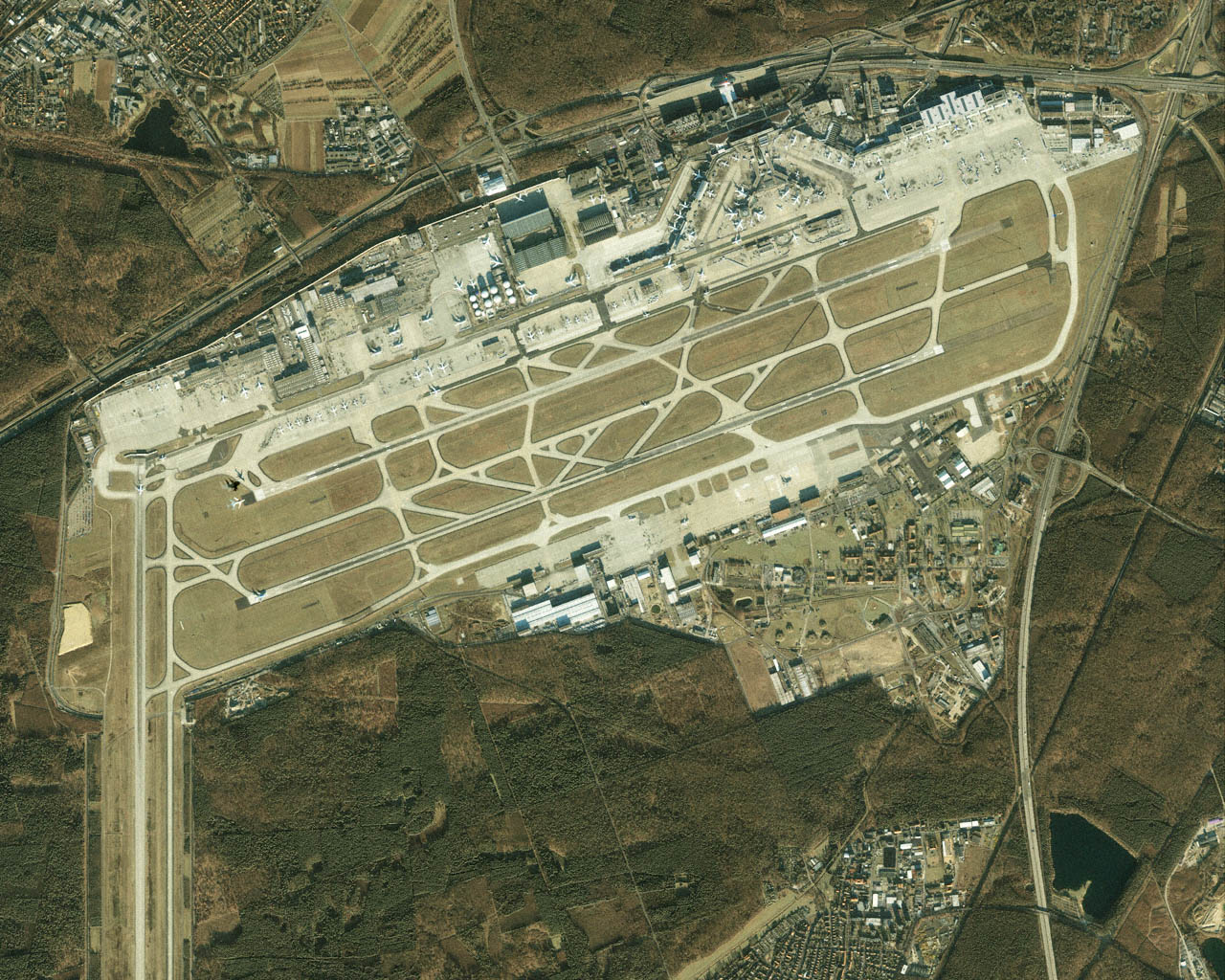
    Ikonos images Frankfurt - Main Airport on 13 January 2001 (source: Space Imaging Europe)

    Frankfurt, 381 Kb
    (for full resolution (381 Kb) click in the image)


  • 14.06.2001
    Rain Forest, Brasil

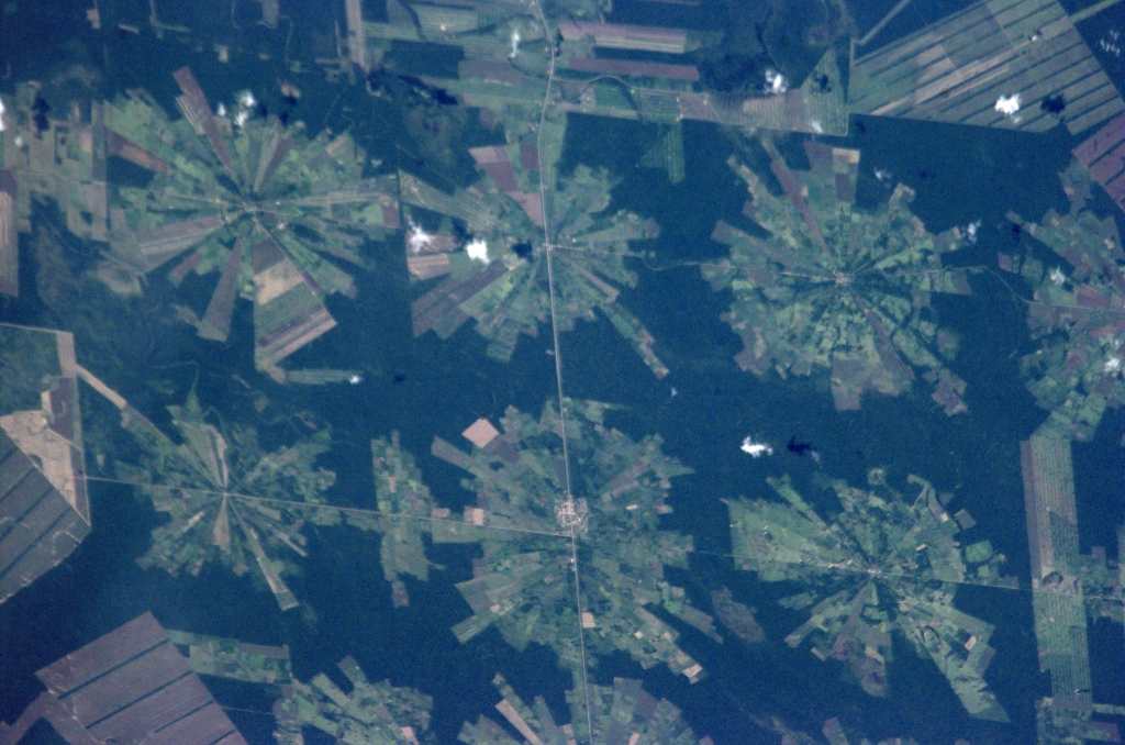
    Shuttle image of deforestation in Brasil, 16-04-01 (source: NASA)

    Rain Forest, 71 Kb
    (for full resolution (71 Kb) click in the image)


  • 08.06.2001
    Aral Sea

    Landsat-ETM images showing the shrinking Aral Sea (source: NASA)

    Aral Sea, 109 Kb
    For more information goto: MFB-Geo


  • 15.05.2001
    Endeavour gets back to Florida

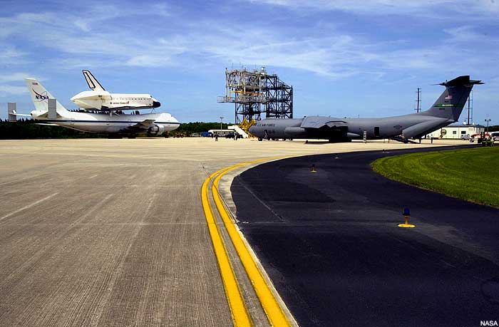
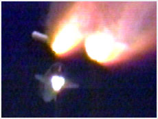
    Endeavour's return from Edwards Air Force Base (CA) to Kennedy Space Center (FL)

    endeavour, 25Kb endeavour, 42Kb
    left: ontop of a B747 (25Kb); right: with a C141 Pathfinder (42Kb)(09-MAY-01)

    For more information goto: NASA


  • 10.05.2001
    City Views from Space

    Satellite data archives showing a variety of cities around the globe

    Ikonos 1m, London
    For getting to the archives goto: Space.Com.City


  • 30.04.2001
    ERDAS / Leica Geosystems

    Leica Geosystems will acquire 100% of the shares of ERDAS, Inc.

    Leica Geosystems Leica Geosystems
    Leica Geosystems announced on 27 April the signing of two acquisition agreements. The Company will acquire 100% of the shares of ERDAS, Inc., a pioneer and the market leader in remote sensing software. Simultaneously, Leica Geosystems will acquire the remaining 50% of the outstanding shares of LH Systems, a pioneer and one of the leaders in aerial photography, remote sensing, and photogrammetry, from its Joint Venture partner BAE Systems. ERDAS and LH Systems, both headquartered in the United States, will form the core of Leica Geosystems' new GIS and Mapping Division and provide a platform for growth in the attractive Geographic Information System (GIS) and Remote Sensing (RS) market segments. With the completion of these two acquisitions, Leica Geosystems will provide the most comprehensive spectrum of technologies and solutions for integrated spatial measurement, remote sensing and mapping with Geographic Information Systems world-wide. Leica Geosystems will acquire ERDAS Inc. for approximately US$ 30 million in cash plus registered shares of the Company. The acquisition of LH Systems will be concluded at a price of US$ 15 million and will be an all-cash transaction.

    For more information goto: ERDAS or Leica Geosystems


  • 24.04.2001
    ALPHA / ISS

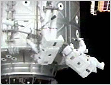
    Rafaello docks with Unity Module
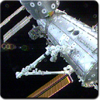
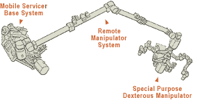
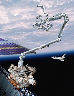
    The Italian-built Raffaello Module, a container with equipment, clothes, food and new scientific experiments for the Alpha Crew docked at the Unity Module of Alpha.

    Raffaello and Canadarm, 22 Kb
    For more information goto: NASA


  • 23.04.2001
    ALPHA / ISS

    Canadarm installed

    The Endeavour Crew has successfully installed the 17.6-meter mechanical Canadarm2 at the exterior of the Destiny Laboratory.

    canadarm, 6 Kb canadarm, 23 Kb
    eva-endeavour/destiny, 12 Kb
    For more information goto: NASA


  • 19.04.2001
    ALPHA / ISS

    Space Shuttle Endeavour (STS100) successfully launched

    The space shuttle Endeavour blasted off Thursday carrying a multinational crew on an 11-day mission to the orbiting International Space Station. The crew of seven -- four US astronauts, a Canadian, an Italian and a Russian -- have as their chief goal the installation of the 17.6-meter mechanical Canadarm2 on the exterior of the station's US-built Destiny laboratory module. They also were to deliver the Italian-made Raffaello module, a container with equipment, clothes, food and new scientific experiments for the ISS crew, including plant growth in zero gravity and radiation in space.

    endeavour, 14 Kb
    For more information goto: NASA


  • 06.04.2001
    Lingshui Military Airfield,
    Hainan Island, South China Sea


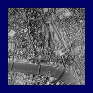
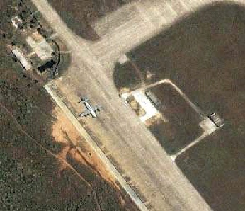
    Ikonos images US reconnaissance aircraft

    This one-meter resolution, color satellite image was collected at 10:12 a.m. local time on April 4, 2001 (10:12 p.m. EDT on April 3, 2001) by Space Imaging's IKONOS satellite. The United States navy aircraft is clearly visible and parked on the taxiway adjacent to the north end of the runway (north is up). This is the first high-resolution commercial satellite image taken of the Lingshui airfield.

    airplane, 50 Kb
    for more information goto: Space.Com


  • 03.04.2001
    New system and software engineer at MFB-GeoConsulting

    Markus Freudiger - a former ASCOM engineer - has many years of experience in software development, database design and system maintenance. The MFB-GeoConsulting team welcomes Markus and wishes him all the best in his new position.

    M. Freudiger, 11 Kb